CODE RED WEATHER: Winter Storm Warning expires for Midstate


UPDATE: A Winter Storm Warning has expired for Middle Tennessee. Drivers are advised to use caution if travel is necessary.
----------------
FOX 17 News is in a Code Red Weather alert for a Winter Storm Warning issued through Saturday morning.
A Winter Storm Warning has been issued for parts of Middle Tennessee until 8 a.m. Saturday. Counties under the warning include: Macon, Clay, Pickett, Wilson, Trousdale, Smith, Jackson, Putnam, Overton, Fentress, Marshall, Rutherford, Cannon, De Kalb, White, Cumberland, Bedford, Coffee, Warren, Grundy, Van Buren, and Giles.
{sd-embed class="sd-embedded-media" data-embed-file="1502481894201511937" data-embed-type="twitter" contenteditable="false"}{/sd-embed}
Chief Meteorologist Katy Morgan says rain and snow accumulation are possible Friday night into Saturday morning as temperatures continue to drop throughout the week.
{sd-embed class="sd-embedded-media" data-alt="WZTV" data-caption="WZTV" data-duration="110" data-externalid="a60843faa1264d318593f3440fe2e9ac" data-mediatype="video" data-renditions="" data-thumburl="https://sinclair-vod-assets.sinclairstoryline.com/a60843faa1264d318593f3440fe2e9ac/thumbnails/poster.jpg" data-title="Winter%20Weather" data-url="https://sinclair-vod-assets.sinclairstoryline.com/a60843faa1264d318593f3440fe2e9ac/hls/index.m3u8" data-defaultthumb="true" data-embed-file="%3Cdiv%20class=%22sda-VideoEmbed%22%3E%0A%20%20%20%20%20%20%20%20%20%20%20%20%3Cdiv%20class=%22sda-video-media-no-thumb%22%3E%0A%20%20%20%20%20%20%20%20%20%20%20%20%3Ciframe%0A%20%20%20%20%20%20%20%20%20%20%20%20%20%20%20%20width=%22560%22%0A%20%20%20%20%20%20%20%20%20%20%20%20%20%20%20%20height=%22315%22%0A%20%20%20%20%20%20%20%20%20%20%20%20%20%20%20%20class=%22sda-embeded-player-iframe%20sda-VideoEmbed-iframe%22%0A%20%20%20%20%20%20%20%20%20%20%20%20%20%20%20%20src=%22/resources/embeds/vod.html?externalId=a60843faa1264d318593f3440fe2e9ac&thumbUrl=https%253A%252F%252Fsinclair-vod-assets.sinclairstoryline.com%252Fa60843faa1264d318593f3440fe2e9ac%252Fthumbnails%252Fposter.jpg%22%0A%20%20%20%20%20%20%20%20%20%20%20%20%20%20%20%20frameborder=%22no%22%3E%0A%20%20%20%20%20%20%20%20%20%20%20%20%3C/iframe%3E%0A%20%20%20%20%20%20%20%20%20%20%20%20%3Cdiv%20class=%22sda-VideoEmbed-caption-no-thumb%22%3E%0A%20%20%20%20%20%20%20%20%20%20%20%20%20%20%20%20%20%20%20%20%3Cspan%3ECaption:%20WZTV%3C/span%3E%0A%20%20%20%20%20%20%20%20%20%20%20%20%20%20%20%20%3C/div%3E%0A%20%20%20%20%20%20%20%20%3C/div%3E%0A%20%20%20%20%20%20%20%20%20%20%20%20%0A%20%20%20%20%20%20%20%20%3C/div%3E" data-embed-type="video" contenteditable="false"}{/sd-embed}
Meteorologist Greg Bobos says Friday will see high temperatures in the upper 60's before the aggressive cold front sweeps across Middle Tennessee later that night.
This front will bring rain with a transition to snow after sunset on Friday.
{sd-embed class="sd-embedded-media" data-alt="Storm%20Impact%20Level%2031122.jpg" data-caption="Storm%20Impact%20Level%20(WZTV)%7B%7D" data-duration="" data-externalid="1d084bcb-56e3-47bf-b5bf-0ba3f9cf09d8" data-mediatype="image" data-renditions="%7B%22large16x9%22:%7B%22blurSigma%22:-1,%22height%22:1080,%22label%22:%22large16x9%22,%22scaleWidth%22:986,%22url%22:%22/resources/media/1d084bcb-56e3-47bf-b5bf-0ba3f9cf09d8-large16x9_StormImpactLevel31122.jpg?1646990873495%22,%22width%22:1920,%22x%22:0,%22y%22:0,%22uuid%22:null,%22id%22:%2239539fcd-664d-4560-92bc-431b30b4c508%22,%22preciseWidth%22:null,%22preciseHeight%22:null,%22name%22:%22large16x9Url%22,%22rendition%22:%22large16x9%22,%22labelOrConvertedName%22:%22large16x9%22%7D,%22jumbo16x9%22:%7B%22blurSigma%22:-1,%22height%22:1080,%22label%22:%22jumbo16x9%22,%22scaleWidth%22:1320,%22url%22:%22/resources/media/1d084bcb-56e3-47bf-b5bf-0ba3f9cf09d8-jumbo16x9_StormImpactLevel31122.jpg?1646990873544%22,%22width%22:1920,%22x%22:0,%22y%22:0,%22uuid%22:null,%22id%22:%22bf9bde3f-cf60-4b57-bac0-0873bfb919eb%22,%22preciseWidth%22:null,%22preciseHeight%22:null,%22name%22:%22jumbo16x9Url%22,%22rendition%22:%22jumbo16x9%22,%22labelOrConvertedName%22:%22jumbo16x9%22%7D,%22small16x9%22:%7B%22blurSigma%22:-1,%22height%22:1080,%22label%22:%22small16x9%22,%22scaleWidth%22:160,%22url%22:%22/resources/media/1d084bcb-56e3-47bf-b5bf-0ba3f9cf09d8-small16x9_StormImpactLevel31122.jpg?1646990877097%22,%22width%22:1920,%22x%22:0,%22y%22:0,%22uuid%22:null,%22id%22:%22776a4c6b-8d24-42e3-831c-a19931dd938e%22,%22preciseWidth%22:null,%22preciseHeight%22:null,%22name%22:%22small16x9Url%22,%22rendition%22:%22small16x9%22,%22labelOrConvertedName%22:%22small16x9%22%7D,%22full16x9%22:%7B%22blurSigma%22:-1,%22height%22:1080,%22label%22:%22full16x9%22,%22scaleWidth%22:1920,%22url%22:%22/resources/media/1d084bcb-56e3-47bf-b5bf-0ba3f9cf09d8-full16x9_StormImpactLevel31122.jpg?1646990873517%22,%22width%22:1920,%22x%22:0,%22y%22:0,%22uuid%22:null,%22id%22:%22aed57cec-2a64-4ad6-99cf-c7bcaed65fce%22,%22preciseWidth%22:null,%22preciseHeight%22:null,%22name%22:%22full16x9Url%22,%22rendition%22:%22full16x9%22,%22labelOrConvertedName%22:%22full16x9%22%7D,%22medium16x9%22:%7B%22blurSigma%22:-1,%22height%22:1080,%22label%22:%22medium16x9%22,%22scaleWidth%22:648,%22url%22:%22/resources/media/1d084bcb-56e3-47bf-b5bf-0ba3f9cf09d8-medium16x9_StormImpactLevel31122.jpg?1646990873348%22,%22width%22:1920,%22x%22:0,%22y%22:0,%22uuid%22:null,%22id%22:%22d4894b98-37f1-400c-9d27-623ad6122020%22,%22preciseWidth%22:null,%22preciseHeight%22:null,%22name%22:%22medium16x9Url%22,%22rendition%22:%22medium16x9%22,%22labelOrConvertedName%22:%22medium16x9%22%7D%7D" data-thumburl="/resources/media/1d084bcb-56e3-47bf-b5bf-0ba3f9cf09d8-medium16x9_StormImpactLevel31122.jpg?1646990873348" data-title="Storm%20Impact%20Level%20(WZTV)%20" data-url="" data-defaultthumb="true" data-embed-file="%0A%20%20%20%20%3Cdiv%20class=%22sda-ImageEmbed%22%3E%0A%20%20%20%20%20%20%20%20%3Cimg%20src=%22/resources/media/1d084bcb-56e3-47bf-b5bf-0ba3f9cf09d8-medium16x9_StormImpactLevel31122.jpg?1646990873348%22%20alt=%22%22%20/%3E%0A%20%20%20%20%20%20%20%20%3Cdiv%20class=%22sda-ImageEmbed-caption%22%3EStorm%20Impact%20Level%20(WZTV)%3C/div%3E%0A%20%20%20%20%3C/div%3E%0A" data-embed-type="image" contenteditable="false" }<="" sd-embed="">{/sd-embed}
Greg says a Winter Weather Advisory goes in effect west of I-65 at 6 p.m. Friday until 6 a.m. Saturday. These areas will start with rain which will quickly transition to snow early Friday night. You can expect to see 1" to 2" of snow, however a few isolated pockets could see totals slightly above 2".
A Winter Storm Watch goes into effect east of I-65 at 9 p.m. Friday until 8 a.m. Saturday. This portion of Middle Tennessee and Southern Kentucky will be bracing for a snowfall of 2" to 4" with areas close to East Tennessee falling into the 4" range.
Rain will begin to transition into snow after 6 p.m., with the most impressive amounts of snow are expected late Friday night. You can expect to see the snow move out of the area by sunrise Saturday morning.
The incoming snow is a low impact event, but do not let it catch you off guard.
Cold temperatures take over after with highs only in the low 30's on Saturday! It will only be a one-day cold snap as highs creep back into the 50's by Sunday.
{sd-embed class="sd-embedded-media" data-alt="1%20(1).jpg" data-caption="Weekend%20Planner%20(WZTV)" data-duration="" data-externalid="4cd540e7-53ec-4fe9-abf3-f8ce16ee7810" data-mediatype="image" data-renditions="%7B%22jumbo16x9%22:%7B%22blurSigma%22:-1,%22height%22:1080,%22label%22:%22jumbo16x9%22,%22scaleWidth%22:1320,%22url%22:%22/resources/media/4cd540e7-53ec-4fe9-abf3-f8ce16ee7810-jumbo16x9_11.jpg?1646966507172%22,%22width%22:1920,%22x%22:0,%22y%22:0,%22uuid%22:null,%22id%22:%220e13ef0c-0c44-4b79-9fb0-5172f80d5202%22,%22preciseWidth%22:null,%22preciseHeight%22:null,%22name%22:%22jumbo16x9Url%22,%22rendition%22:%22jumbo16x9%22,%22labelOrConvertedName%22:%22jumbo16x9%22%7D,%22large16x9%22:%7B%22blurSigma%22:-1,%22height%22:1080,%22label%22:%22large16x9%22,%22scaleWidth%22:986,%22url%22:%22/resources/media/4cd540e7-53ec-4fe9-abf3-f8ce16ee7810-large16x9_11.jpg?1646966507203%22,%22width%22:1920,%22x%22:0,%22y%22:0,%22uuid%22:null,%22id%22:%22a6a986fe-5ad8-45a2-9cdc-06740583ad9a%22,%22preciseWidth%22:null,%22preciseHeight%22:null,%22name%22:%22large16x9Url%22,%22rendition%22:%22large16x9%22,%22labelOrConvertedName%22:%22large16x9%22%7D,%22small16x9%22:%7B%22blurSigma%22:-1,%22height%22:1080,%22label%22:%22small16x9%22,%22scaleWidth%22:160,%22url%22:%22/resources/media/4cd540e7-53ec-4fe9-abf3-f8ce16ee7810-small16x9_11.jpg?1646966510564%22,%22width%22:1920,%22x%22:0,%22y%22:0,%22uuid%22:null,%22id%22:%22023ab36b-e148-4850-a261-a40e530a2f92%22,%22preciseWidth%22:null,%22preciseHeight%22:null,%22name%22:%22small16x9Url%22,%22rendition%22:%22small16x9%22,%22labelOrConvertedName%22:%22small16x9%22%7D,%22full16x9%22:%7B%22blurSigma%22:-1,%22height%22:1080,%22label%22:%22full16x9%22,%22scaleWidth%22:1920,%22url%22:%22/resources/media/4cd540e7-53ec-4fe9-abf3-f8ce16ee7810-full16x9_11.jpg?1646966507197%22,%22width%22:1920,%22x%22:0,%22y%22:0,%22uuid%22:null,%22id%22:%224cebc7d6-1213-4549-9e88-fbe97ab6ed4b%22,%22preciseWidth%22:null,%22preciseHeight%22:null,%22name%22:%22full16x9Url%22,%22rendition%22:%22full16x9%22,%22labelOrConvertedName%22:%22full16x9%22%7D,%22medium16x9%22:%7B%22blurSigma%22:-1,%22height%22:1080,%22label%22:%22medium16x9%22,%22scaleWidth%22:648,%22url%22:%22/resources/media/4cd540e7-53ec-4fe9-abf3-f8ce16ee7810-medium16x9_11.jpg?1646966507060%22,%22width%22:1920,%22x%22:0,%22y%22:0,%22uuid%22:null,%22id%22:%22c3eb536d-48db-4633-bef3-9ff65311b974%22,%22preciseWidth%22:null,%22preciseHeight%22:null,%22name%22:%22medium16x9Url%22,%22rendition%22:%22medium16x9%22,%22labelOrConvertedName%22:%22medium16x9%22%7D%7D" data-thumburl="/resources/media/4cd540e7-53ec-4fe9-abf3-f8ce16ee7810-medium16x9_11.jpg?1646966507060" data-title="CODE%20RED%20WEATHER:%20Rain,%20snow%20possible%20late%20Friday%20night%20into%20Saturday%20morning" data-url="" data-defaultthumb="true" data-embed-file="%0A%20%20%20%20%3Cdiv%20class=%22sda-ImageEmbed%22%3E%0A%20%20%20%20%20%20%20%20%3Cimg%20src=%22/resources/media/4cd540e7-53ec-4fe9-abf3-f8ce16ee7810-medium16x9_11.jpg?1646966507060%22%20alt=%22%22%20/%3E%0A%20%20%20%20%20%20%20%20%3Cdiv%20class=%22sda-ImageEmbed-caption%22%3EWeekend%20Planner%20(WZTV)%3C/div%3E%0A%20%20%20%20%3C/div%3E%0A" data-embed-type="image" contenteditable="false"}{/sd-embed}
Road temperatures will be very warm until well after sunset. Initial snowfall will melt on contact until our roads cool enough.
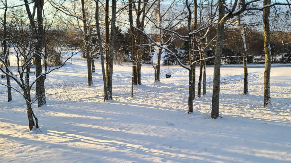
Expect accumulations to be higher in grassy areas and on non-paved surfaces.
Snow will move out very early Saturday morning, but snow may not melt until Sunday afternoon with temperatures in the mid 30's Saturday.
Download the FREE FOX 17 Code Red Weather App for your iPhone, iPad or Android.